Location: Abu Dhabi, UAE
Deliverable: Master plan, landscape design
Key Features: sustainable infrastructure master planning, passive urban grid design, integrated ecosystem management
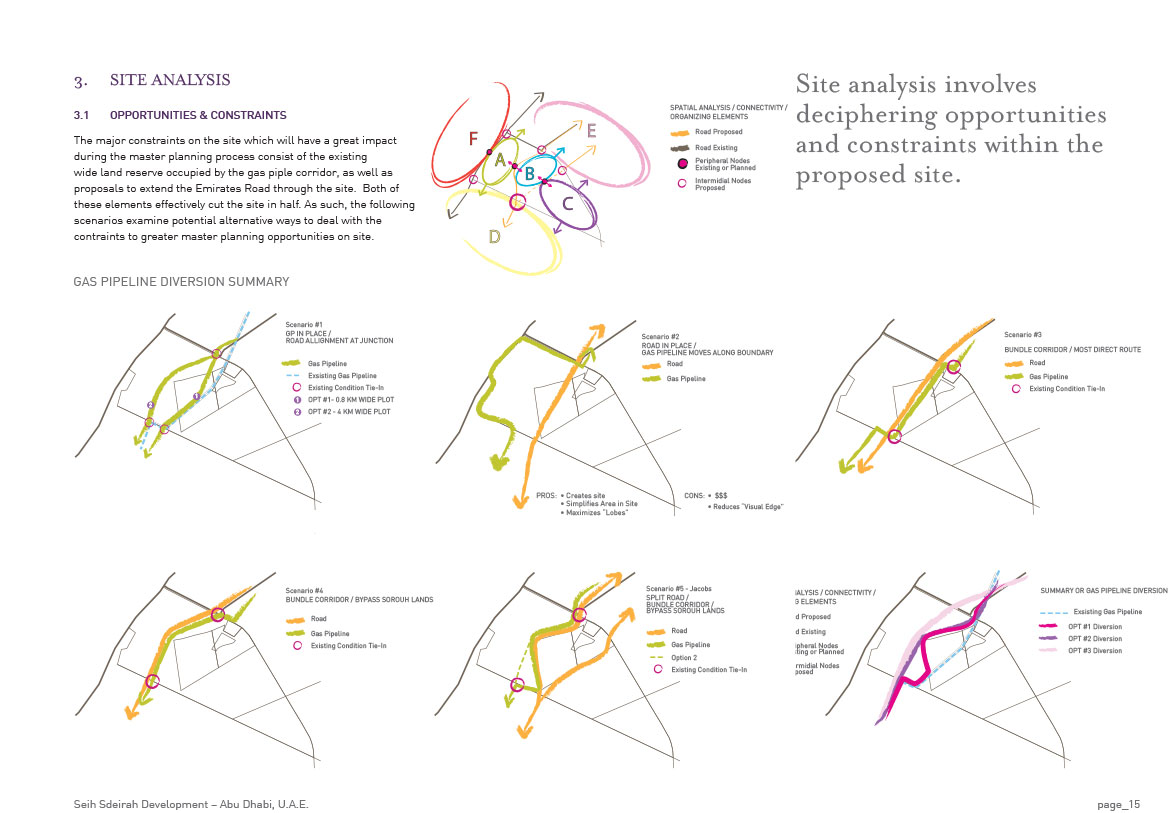
Seih Sderiah is envisioned as a new urban centre along the border of the Dubai and Abu Dhabi Emirates and represents an ideal opportunity for economic diversification and market growth. The 26,000ha site master plan is identified as an initiative of the larger Plan 2030 for the Abu Dhabi Emirate to establish a strong inter-Emirate connection. The Master Plan is a framework plan to develop a foundation for managing the site’s future development and growth.
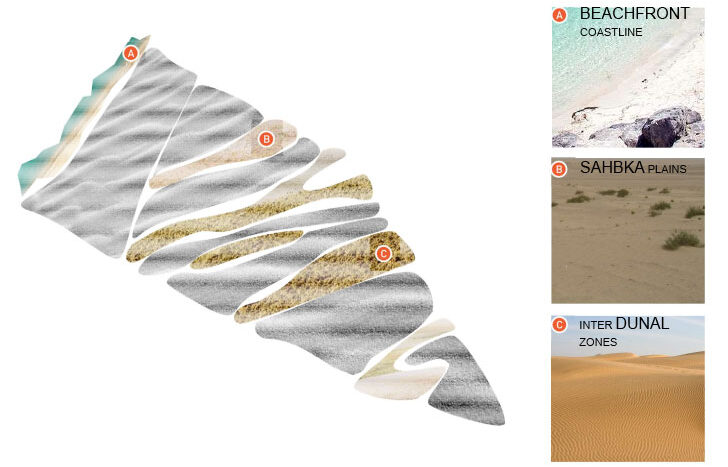
A west-south-west/east-north-east axis for the foundational urban grid axis was identified through an initial inventory of the site’s environmental features. Research into the site revealed that the dune pattern and formations found on the site appeared to be reinforced by the natural regional drainage networks towards the sea. Globally, the United Arab Emirates falls within the Arabian Desert and East Sahero-Arabian xeric shrublands ecoregion classification, which is in a critical/endangered state according to the World Wildlife Fund. The urban framework and grid of the Seih Sdeirah regional plan was built around maintaining dune creation and succession such that the urban developments would not impede natural function and flow within the region.
By taking ecosystem variation into consideration at the master planning stages, the design team was able to create an urban framework which aims to minimize the impact of development on the surrounding environment.